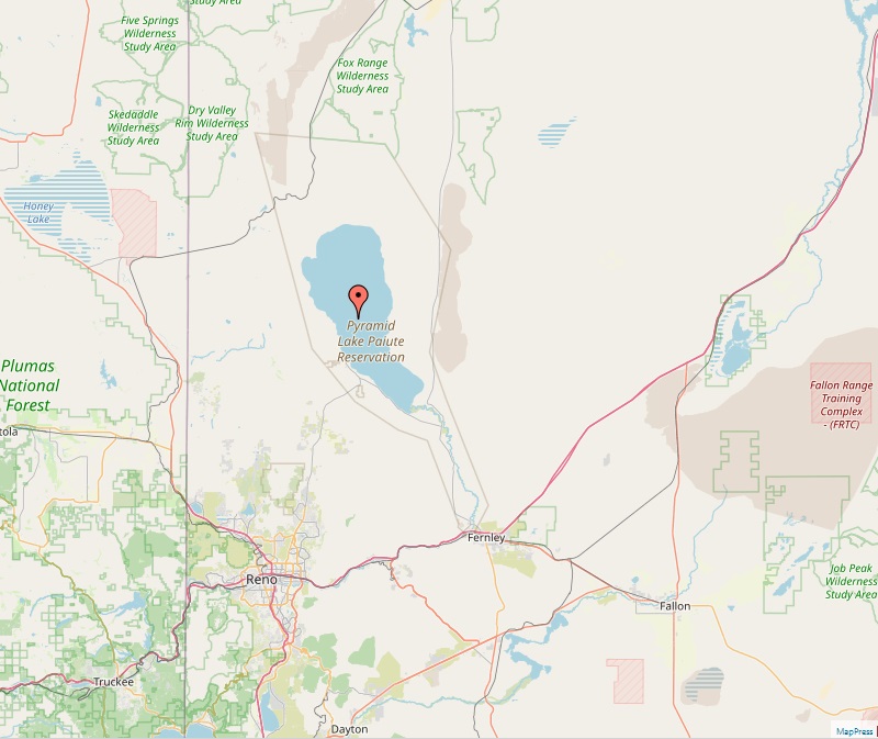
Pyramid Lake (Nevada)
Lake Pyramid, also known as Kooyooe Panunadu in Northern Paiute and Á’waku dáʔaw in Washo, is a remarkable endorheic salt lake located in Washoe County, Nevada. This geographical wonder, a remnant of the ancient Lake Lahontan, stands as a testament to both natural history and the enduring cultural significance of the native Paiute people. Geographical Overview Nestled 40 miles northeast of Reno, Nevada, Lake Pyramid spans a length of 29.8 miles and a maximum width of 8.7 miles, encompassing a surface area of approximately 188 square miles. Its maximum depth reaches 356 feet, and it sits at an elevation of 3,796 feet. The lake's primary inflow is the Truckee River, which enters at its southern end. Historical Significance Lake Pyramid holds a sacred place in the history and culture of…